In the next series of posts I am going to write about my findings of the Northup Trail. This trail begins at the Louisiana State University in Alexandria and leads through Rapides and Avoyelles Parishes. I have in my possession a book which seems to have been a free booklet for visitors to the area, may no longer be in print. I have attempted to contact the University in the past with no luck in obtaining a copy. It's possible that copies may still be sitting in various places throughout the region, but the hope that they are still in production seems highly unlikely. My copy seems very old and I handle it with extreme care.
On the cover of the book, there is a statement: "Prepared by Sue Eakin, Ph.D with assistance in tracing the trail by Harvey Kimble; photographs by Paul Eakin, Sr., and others; illustrations by Isleta Shexnyder; cover art by Charles Saucier, Information Services, Louisiana State University at Alexandria. Funding for this project was provided by the Louisana Committee for the Humanities."
Inside front cover: THE NORTHUP TRAIL
TWELVE YEARS A SLAVE, 1841-1853 by Solomon Northup, edited by Sue Eakin and Joseph Logsdon, was published in 1968 by Louisiana State University Press. The original book, published in 1853, in New York, appeared later in the same year Northup was freed at Avoyelles Parish Courthouse, Marksville. The LSU volume adds the documentation in Central Louisiana - Rapides and Avoyelles Parishes - by Dr. Eakin, and the story of the New York trail of the kidnappers after Northup's release by Dr. Logsdon. It is doubtful any other slave has left a document of such value which has been so thoroughly researched.
THE TRAIL OF SOLOMON NORTHUP THROUGH CENTRAL LOUISIANA represents research of Dr. Eakin's that has taken place over nearly half a century, ever since she was a child living on the Bayou Beouf herself. Bit by bit, place by place, Northup's journey can be traced to afford the feel of reality to life in this country before the Civil War.
William Prince Ford, a Baptist minister of Rapides Parish, went to New Orleans and purchased Northup (called "Platt" as a slave) and returned on the "Rodolph," a steamboat plying the Red River at that period. He brought Platt and two other slaves purchased at New Orleans Slave Market on the Red River Railroad (on the site of the railroad track running in front of LSU Alexandria). The train moved at about three miles an hour, and its terminal was first at Lamourie, a few miles south of the University.
Northup Trail through Central Louisiana
Marked by numbered signs, as indicated
RAPIDES PARISH SITES (Purple background)
- Begins at Louisiana State University at Alexandria
- Lamourie - locks in Bayou Lamourie (1857); site of 1837 terminal of Red River Railroad, first railroad laid west of the Mississippi River
- Smith's Bridge over Bayou Boeuf
- Martin's Springs in the "Great Pine Woods," home of W.C.C.C. Martin
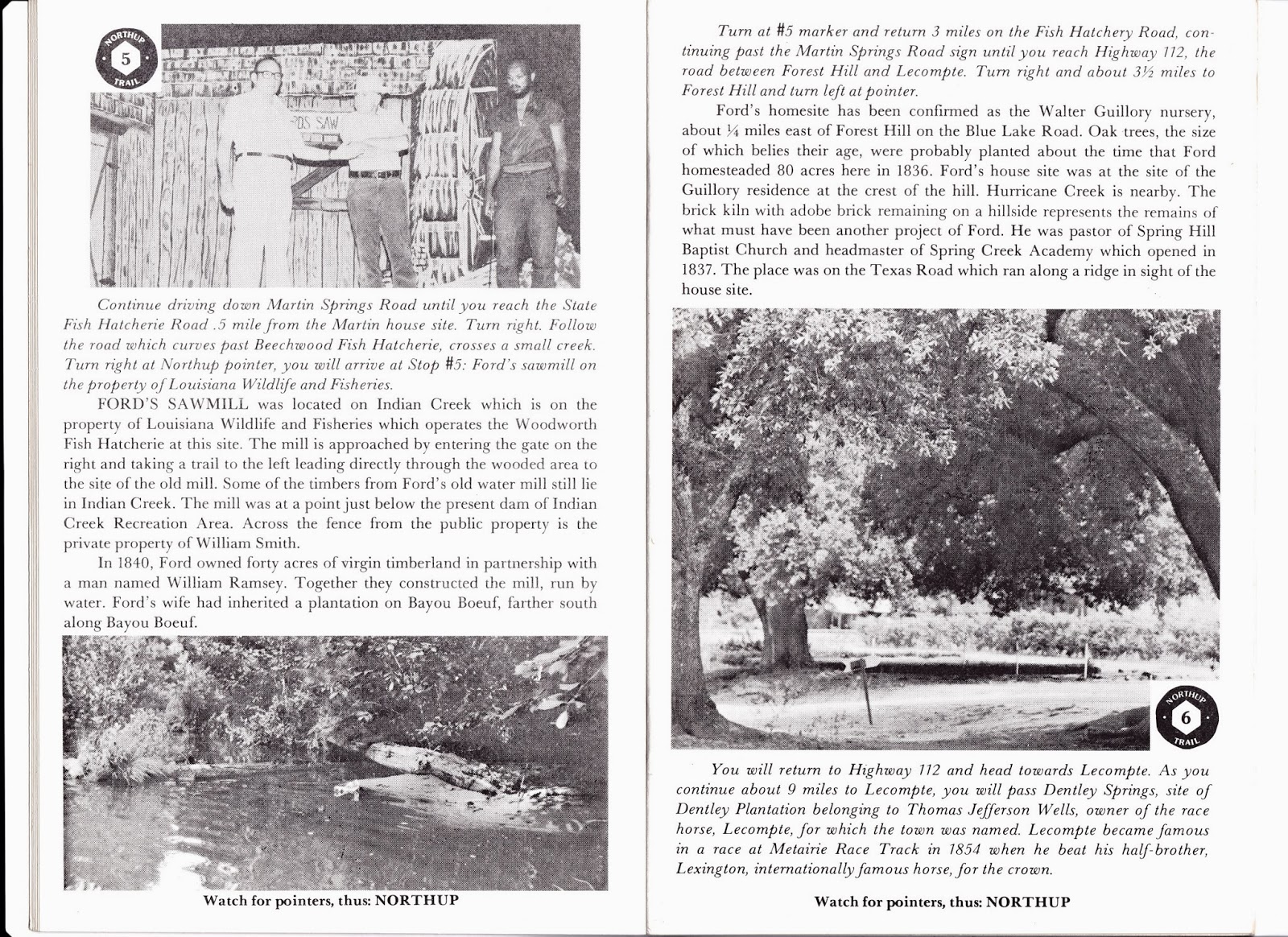
- Site of Ford's sawmill on Indian Creek
- William Prince Ford Home
- Historic Cheneyville, locale of William Prince Ford; Ford, Mary McCoy, and Ralph Smith, Smith buried here; house remaining of Mary McCoy's slave
- Bennettville - bend of bayou store of Ezra Bennett, New York school teacher who migrated to area in 1820's, neighbor to Ford on adjacent plantation.
AVOYELLES PARISH SITES (Black background)
- Edwin Epps House Museum at Bunkie, La.
- Bayou Boeuf: Boundary between Rapides and Avoyelles Parishes
- Home of Mary McCoy as bride in 1854
- Small Port of Holmesville on Bayou Boeuf; *Old Fogleman Cemetery site where Edwin Epps (1867) and wife, Mary (1867) buried.
- Edwin Epps plantation site (home removed)
- P.L. Shaw House
- The Burns House; *Hillcrest, rented plantation of Epps, 1843-44
- Historic Evergreen
- Lone Pine, home of Alanson Pearce
- Historic Marksville, parish seat of Avoyelles
- Avoyelles Parish Courthouse where Solomon Northup was freed
*Unnumbered; discovered in research after Avoyelles Trail begun.