Sunday, July 21, 2013

Stop #3. (Rapides) Smith's Bridge/Indian Creek Reservoir


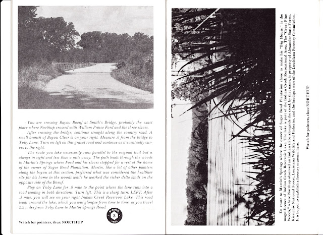
(pg. 7) You are crossing Bayou Beouf at Smith's Bridge, probably the exact place where Northup crossed with William Prince Ford and the three slaves.


Smith's Landing Historical Marker (courtesy of historyhunts)

The Old Depot (courtesy of historyhunts)

After crossing the bridge, continue straight along the country road. A small branch of Bayou Clear is on your right. Measure 0.6 from the bridge to Toby Lane. Turn on left on this gravel road and continue as it eventually curves to the right.

The route you take necessarily runs parallel to the original trail but is always in sight and less than a mile away. The path leads through the woods to Martin's Springs where Ford and his slaves stopped for a rest at the home of the owner of Sugar Bend Plantation. Martin, like a lot of other planters along the bayou at this section, preferred what was considered the healthier site for his home in the woods while he worked the richer delta lands on the opposite side of the Boeuf.
Stay on Toby Lane for 0.8 mile to the point where the lane runs into a road leading in both directions. Turn left. This is a sharp turn: LEFT. After 0.3 mile, you will see on your right Indian Creek Reservoir Lake. This road leads around the lake, which you will glimpse from time to time, as you travel 2.2 miles from Toby Lane to Martin Springs Road.

(pg. 8) En route to Martin's Springs where the owner of Sugar Bend Plantation chose to make his "Big House," is the magnificence of Indian Creek Reservoir Lake. The lake is part of the Indian Creek Recreational Area. The "Great Pine Woods," where Northup observed an Idian tribe alongside the creek by that name, is property of Alexander State Forest, Kisatchie National Forest, Louisiana Wildlife and Fisheries, and the headquarters of the Louisiana Forestry Commission. It is hoped to establish a forestry museum here.


In regard to the Native Americans that Northup noted, I discovered that US Gen Web Archives contains information regarding those Native Americans: 

"The Choctaw settled in a strip running from the Red River in the area of the
Appalaches Village (Zimmerman), south-southeast to Pine Prairie.  The Yowani 
Choctaw were well established in central Louisiana as early as the mid-1750's, 
coming from the permanent village on Bayou Chicot into the vicinity of Clifton.  
There were Choctaw settlements at Boyce, Flatwoods, Clifton Crossing, Hineston, 
Seiper Creek, and Woodworth."
Stop #2. (Rapides) Lamourie Locks/St. John Baptist Church


(pg. 5) The Lamourie Locks were constructed by act of the Louisiana Legislature in 1857 at the insistence of the planters served by the Boeuf system of transportation and by Ralph Smith Smith.

The locks operated with an immense gate pulled up and down by heavy chains or ropes according to the water level of the bayou desired. The Bayou Lamourie in which the locks are located flows into Bayou Beouf a mile or so distant, and the locks regulated the amount of water released into the Boeuf. Navigation in Bayou Boeuf was hazardous from the standpoint of dependability for marketing crops and maintaining a water level sufficiently high enough to float bales of cotton posed a great problem. The old locks were damaged during the Civil War, according to a surviving letter of Ralph Smith Smith.

The following modern photos of the Lamourie Locks were taken  by History Hunts  blog owner. Thank you for allowing me to use them in this blog.


(pg. 6) 
St. John the Baptist Church

This church was founded in 1869 and is now on the National Register of Historic Places, one of the few places involving black history on the National Register.

Ford and his party crossed the railroad and walked down a turning road through fields of Carnal and Flint, the turning row leading the Bayou Boeuf and, beyond it, to the "Great Pine Woods."

As you cross the railroad (the very path where Smith's railroad lay; the line was bought by the Texas and Pacific in late 19th Century), you will see on your left the historic St. John Baptist Church.

Continue past the church 1.1 miles until you arrive at a brick structure on your left: Lamourie Baptist Church. Turn sharply to your left and continue across a small bridge over Bayou Beouf.

Continue on the narrow country road ahead which veers to the left through fields. About 1/2 to 3/4 miles from the bridge is a sign on your right: Ashton Plantation (private).

Continue along the country road which again veers to the left, making a curve along Bayou Boeuf. The Boeuf is at your right as you drive the short distance to cross the bayou at Smith's Bridge. Smith's Bridge over Bayou Boeuf is 2.2 miles from Lamourie Baptist Church where you turned. You are crossing Bayou Boeuf at Smith's Bridge, probably the exact place where Northup crossed with William Prince Ford and the three slaves.

After crossing the bridge continue straight along the country road. A small branch of Bayou Clear is on your right. Measure .6 from the bridge to Toby Lane. Turn left on this gravel road and continue as it eventually curves to the right.

The route you take necessarily runs parallel to the original trail but is always in sight and less than a mile away. The path leads through the woods to Martin's Springs where Ford and his slaves stopped for a rest at the home of the owner of Sugar Bend Plantation. Martin, like a lot of other planters along the bayou at this section, preferred what was considered the healthier site for his home in the woods while he worked for the richer delta lands on the opposite side of the Boeuf.

Stay on Toby Lane for .8 mile to the point where the lane runs into a road leading in both directions. Turn left. This is a sharp turn: LEFT. After .3 mile, you will see on your right Indian Creek Reservoir Lake. This road leads around the lake, which you will glimpse from time to time, as you travel 2.2 miles from Toby Lane to Martin Springs Road.

Stop #1. (Rapides) Louisiana State University at Alexandria


(pg. 4) THE TRAIL OF NORTHUP THROUGH CENTRAL LOUISIANA begins at LSU-Alexandria. Leave the campus and drive [left blank] miles south down Highway 71. You will arrive at a crossroads with a bridge over Bayou Lamourie, and a railroad track at your right. The locks in the bayou are to your left, and to see them well, you will need to park your car and walk across the highway to see these massive brick locks. bayou Lamourie flows into Bayou Beouf a few miles to the west.

Lamourie, which has the strange name of "La Mourir," was a crossroads antebellum community with the terminal of the Red River Railroad, or the Ralph Smith Railroad, located here in 1837. By 1841, when Northup came to this point, the railroad owners had sold sufficient stock to secure funds for extending the road another six miles into Smith's Landing (later named Lecompte). It had only begun when William Prince Ford brought his slaves "on the cars" to Lamourie and disembarked to walk across the plantations toward his home and the sawmill where he planned to use the new slaves.

Lamourie was probably the site of a primitive boarding house, a general store, and a shingle mill owned by A. Levin which produced shingles for the frontier for miles to the west. The shingles from the Lamourie Mill were sent as far as the Oklahoma territory. The shingle mill may have been the reason that Ford was sending logs from his sawmill to Lamourie. In Northup's account he used expertise gained in the northern rafting to lead an expedition into Lamourie and become something of a hero in the savings this represented to Ford.

The Red River Railroad was the first railroad contructed west of the Mississippi River. The primitive train was destroyed during the Civil War by Union forces  and the rails were used in the Bailey Dam in Red River in 1864.

Northup Trail through Central Louisiana

In the next series of posts I am going to write about my findings of the Northup Trail. This trail begins at the Louisiana State University in Alexandria and leads through Rapides and Avoyelles Parishes. I have in my possession a book which seems to have been a free booklet for visitors to the area, may no longer be in print. I have attempted to contact the University in the past with no luck in obtaining a copy. It's possible that copies may still be sitting in various places throughout the region, but the hope that they are still in production seems highly unlikely. My copy seems very old and I handle it with extreme care.


On the cover of the book, there is a statement: "Prepared by Sue Eakin, Ph.D with assistance in tracing the trail by Harvey Kimble; photographs by Paul Eakin, Sr., and others; illustrations by Isleta Shexnyder; cover art by Charles Saucier, Information Services, Louisiana State University at Alexandria. Funding for this project was provided by the Louisana Committee for the Humanities."

Inside front cover: THE NORTHUP TRAIL


TWELVE YEARS A SLAVE, 1841-1853 by Solomon Northup, edited by Sue Eakin and Joseph Logsdon, was published in 1968 by Louisiana State University Press. The original book, published in 1853, in New York, appeared later in the same year Northup was freed at Avoyelles Parish Courthouse, Marksville. The LSU volume adds the documentation in Central Louisiana - Rapides and Avoyelles Parishes - by Dr. Eakin, and the story of the New York trail of the kidnappers after Northup's release by Dr. Logsdon. It is doubtful any other slave has left a document of such value which has been so thoroughly researched.

THE TRAIL OF SOLOMON NORTHUP THROUGH CENTRAL LOUISIANA represents research of Dr. Eakin's that has taken place over nearly half a century, ever since she was a child living on the Bayou Beouf herself. Bit by bit, place by place, Northup's journey can be traced to afford the feel of reality to life in this country before the Civil War.
William Prince Ford, a Baptist minister of Rapides Parish, went to New Orleans and purchased Northup (called "Platt" as a slave) and returned on the "Rodolph," a steamboat plying the Red River at that period. He brought Platt and two other slaves purchased at New Orleans Slave Market on the Red River Railroad (on the site of the railroad track running in front of LSU Alexandria). The train moved at about three miles an hour, and its terminal was first at Lamourie, a few miles south of the University.

Northup Trail through Central Louisiana
Marked by numbered signs, as indicated

RAPIDES PARISH SITES (Purple background)
  1. Begins at Louisiana State University at Alexandria
  2. Lamourie - locks in Bayou Lamourie (1857); site of 1837 terminal of Red River Railroad, first railroad laid west of the Mississippi River
  3. Smith's Bridge over Bayou Boeuf
  4. Martin's Springs in the "Great Pine Woods," home of W.C.C.C. Martin
  5. Site of Ford's sawmill on Indian Creek
  6. William Prince Ford Home
  7. Historic Cheneyville, locale of William Prince Ford; Ford, Mary McCoy, and Ralph Smith, Smith buried here; house remaining of Mary McCoy's slave
  8. Bennettville - bend of bayou store of Ezra Bennett, New York school  teacher who migrated to area in 1820's, neighbor to Ford on adjacent plantation.

AVOYELLES PARISH SITES (Black background)
  1. Edwin Epps House Museum at Bunkie, La.
  2. Bayou Boeuf: Boundary between Rapides and Avoyelles Parishes
  3. Home of Mary McCoy as bride in 1854
  4. Small Port of Holmesville on Bayou Boeuf; *Old Fogleman Cemetery site where Edwin Epps (1867) and wife, Mary (1867)  buried.
  5. Edwin Epps plantation site (home removed)
  6. P.L. Shaw House
  7. The Burns House; *Hillcrest, rented plantation of Epps, 1843-44
  8. Historic Evergreen
  9. Lone Pine, home of Alanson Pearce
  10. Historic Marksville, parish seat of Avoyelles
  11. Avoyelles Parish Courthouse where Solomon Northup was freed
*Unnumbered; discovered in research after Avoyelles Trail begun.